
Uralkali-Supported Space-Based Monitoring Project
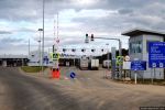
OREANDA-NEWS. July 26, 2007. An international research satellite began to monitor the subsidence in Berezniki, Perm Territory. Satellite monitoring data obtained by using satellite radar interferometry will ensure integrated status monitoring aiming to forecast, prevent, and mitigate the effects of the flooding of Uralkali's First Mine. In 2007, Uralkali plans to invest more than 3 million rubles in the project, which is being implemented by scientists from the Germany-based Clausthal University of Technology together with the Mining Institute of the Ural Branch of the Russian Academy of Sciences.
Satellite monitoring covers the total area of the city of Berezniki, divided into square plots of 25 x 25 meters. Satellite shots are processed with a special technique and forwarded to the Mining Institute. Today, satellite observations have confirmed all the main findings of scientists about the stable and predictable changes in the situation in the accident zone. At the suggestion of experts, its was decided to use one more satellite for monitoring, which will allow measurements to be obtained every 11 days (against every 35 days at present) and the size of satellite-monitored plots to be substantially decreased to 3 x 3 meters.
Arkady Krasnoshtein, Director, Mining Institute of the Ural Branch of the Russian Academy of Sciences:
"Satellite radar technology has material advantages over surface methods for monitoring subsidence. The comprehensive implementation of integrated space, surface, and subsurface monitoring of changes in and the state of the land surface will enable us to forecast critical situations in space and time and promptly develop the necessary protective measures, which will make it possible to mitigate an adverse impact of the mine flooding on Berezniki."
After the October 2006 accident at the First Mine, the Government Commission established to prevent any adverse effects of the mine flooding, assigned Uralkali the task of ensuring constant monitoring of the land surface in the accident area. To fulfill the task, the Company arranged mine surveys, installed special measuring equipment monitoring surface deformation, and is engaged in seismic observations and geophysical exploration examining the state of the subsurface part of the geologic section.
Sergey Dyakov, Deputy Director General, Uralkali:
"In carrying out the assignment given by the Government Commission, we strive to apply all advance technologies currently available to scientists to solve our complicated and unique task. Space-based observations will enable us to obtain more detailed and reliable information."
Комментарии