


Key to Chayanda’s treasures
OREANDA-NEWS. Gazprom Geologorazvedka completed large-scale seismic survey operations at the Chayandinskoye oil, gas & condensate field in the Republic of Sakha (Yakutia).
Here the company applied the high-density wide azimuth (WAZ) 3D survey method for the first time ever. Not too long before the end of the investigations the field was visited by Far Eastern media representatives to get acquainted with the modern prospecting technologies. This photo essay is based on the pictures made by the press tour participants.
The scope of geophysical exploration in the Chayanda licensed block covered 6.300 square meters. Gazprom Geologorazvedka conducted seismic surveys across the area of 5.800 square meters. Even the pictures taken from a helicopter can’t convey the tremendous scale of this project.
But the bird-eye perspective gives a very clear view of the gauges laid by the forest workers: they divide Chayanda (that’s what gas workers call the Chayandinskoye field) into 300x150 meter sections.
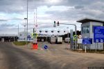
A settlement of seismic crew No. 22 is an islet of civilization in the Yakutian taiga. It has everything necessary for a full-fledged life and work – a canteen, laundry, bath-house, medical room. There is even a small shop and an on-site bakery there.
In order to make the seismic survey efficient, the field is divided into eight subsections with the areas from 600 to 800 square meters in size. The journalists landed at one of them.
Even though there is deep forest around, it is next to impossible to get lost within the section: there are transfer cables everywhere – bright wires that will lead you to people in any case.
There are really a lot of people at Chayanda: the research was conducted by three seismic crews totaling about one thousand people.
In the daytime the seismic crews move around the taiga on cross-country vehicles, installing special equipment along the perimeter of the laid forest corridors.
Here’s what seismic receivers look like – devices which convert mechanical vibration into an electrical signal. A seismic receiver makes it possible to detect the acoustic wave arrival time as well as define its dynamic parameters – frequency, period, amplitude and initiation. The workers call seismic receivers ‘carrots’ for their peculiar color and shape.
Ramil Selimzhanov, seismic worker of the second category is busy installing the seismic receivers. During the shift he ‘plants’ up to 200 ‘carrots’ into the snow and collects the same amount of the worked-out devices.
At crossing points the cables are connected to geophysical information collection and transmission modules.
Once the seismic receivers and transmission modules are installed and their operability is tested by the seismic station, huge machines – NOMAD-65 seismic vibrators (from French ‘nomad’ – ‘wanderer’) come into action.
These ‘wanderers’ stop only to make a small artificial earthquake. The cameraman of the Amur State TV and Radio Broadcasting Company films the process: a massive plate comes out from under the vehicle bottom and excites a seismic wave. A blast – and energy penetrates the subsurface, ricochets from dense formations and goes back, while the vibrations are recorded by the seismic receivers installed in advance.
The collected data is delivered through the transmission modules to the seismic station which is also located here at the section. It is called the backbone of the seismic survey procedure. Instructions for vibrator operators are given from here and it also monitors the integrity of seismic recording equipment.
“On your right you can see a seismic record: each line represents a channel,” tells us Renat Khafizov, a seismic station operator. “If transmission cable breakdowns occur somewhere, it is displayed on the screen, and a shift engineer fixes the faults”.
Alexander Pogretsky, Head of the Geophysical Operations and Surveys Division of Gazprom Geologorazvedka explains the advantages of the high-density wide azimuth technique to the journalists: “2D seismic makes it possible to get only a vertical cross section of the earth’s crust, while the 3D survey results in a three-dimensional image of the field’s subsurface. It was for the first time ever in Russia that this method was applied on such a vast area.”
Further processing and interpretation of the data obtained during the surveys will allow Gazprom Geologorazvedka to develop a 3D model of the Chayandinskoye oil, gas & condensate field, which will help to detect the most prospective areas for drilling. First gas is to be produced at the field in late 2018.
Комментарии