
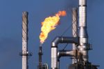

Lukoil Conducts Satellite Monitoring of North Caspian Sea
OREANDA-NEWS. March 18, 2010. ООО LUKOIL-Nizhnevolzhskneft (an OAO LUKOIL wholly-owned subsidiary) obtained the results of satellite monitoring for the
The monitoring was aimed at tracing pollution and identifying its sources during the assembly of an offshore ice-resistant stationary platform at Yu. Korchagin field. After quasi-real processing, the satellite data were sent to specialists of OOO LUKOIL-Nizhnevolzhskneft via the web-service LUKOIL-Kosmosnimki.
No oil spills have been traced during the monitoring period within the boundaries of the license areas of OOO LUKOIL-Nizhnevolzhskneft.
To trace pollutants and their sources, a multi-satellite monitoring technique was used, which ensured a high frequency of observation and direct satellite image acquisition. These observations efficiently control license areas and the neighboring sites, ensuring a high probability of pollution tracking.
The monitoring also allows engineers to trace the spill drifting dynamics and the cases of offshore zone pollution caused by oil spill transfers to license areas affected by hydrometeorological factors. Thanks to the integrated use of satellites and other types of information, it is possible to define the nature and possible sources of pollution (for instance, related vessels which often cross license areas and may serve as sources of petroleum product discharges within the boundaries of the license areas of OOO LUKOIL-Nizhnevolzhskneft).
The greater part of the traced pollution in the waters of the
Комментарии